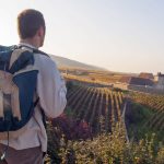
Exploring Burgundy’s rolling vineyards, historic towns, and scenic rivers is easier when you rely on comprehensive travel resources for Burgundy. Maps, guides, and online tools help travelers plan their routes, discover hidden gems, and make the most of their visit. Whether you are visiting for wine, culture, or history, knowing where to go and how to navigate can save time and enrich your experience. This guide will provide practical advice on maps, apps, guides, and planning tools that every traveler should consider.
With these tools, you can design an itinerary that balances must-see landmarks with off-the-beaten-path treasures. Below is a concise overview to prepare you for a smooth exploration of Burgundy.
Travel Resources for Burgundy: What You Need to Know
Before heading out, it’s essential to understand the types of resources available for navigating Burgundy. Travelers can use printed maps, digital applications, specialized hiking or cycling guides, and local tourist offices to create an enjoyable and organized trip. Each resource serves a unique purpose, helping you explore the region with confidence and ease.
The following bullet points summarize the most useful travel resources for planning your journey:
- Detailed printed maps for towns, wine routes, and natural areas.
- Interactive digital maps and GPS apps for real-time navigation.
- Specialized hiking and cycling guides highlighting trails and scenic routes.
- Tourist office brochures and local guides for events, attractions, and seasonal information.
These resources form the foundation for a well-planned Burgundy adventure, ensuring that you spend less time guessing and more time experiencing.
Understanding Travel Resources for Burgundy
Using the right tools can transform your visit to Burgundy from confusing to seamless. Travel resources help you locate key towns, vineyards, and historical sites while giving insight into distances and travel times. Maps and guides also enhance your understanding of local culture, regional cuisine, and natural landscapes.
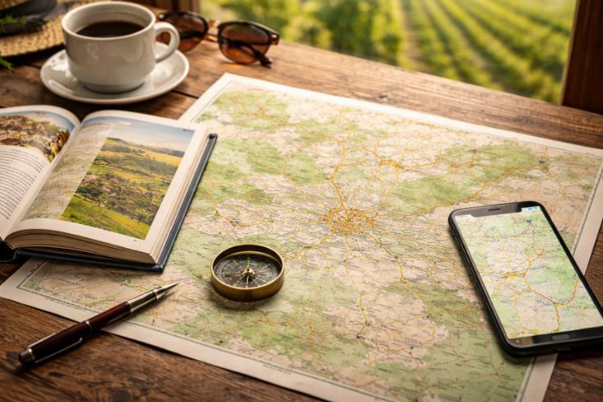
Printed Maps and Guidebooks
Printed maps remain a reliable companion for travelers who prefer a tactile approach to navigation. They highlight towns, landmarks, wine routes, and historical sites. Maps are often available in bookstores, tourist offices, and online.
Pairing printed maps with a Dijon travel guide can make city exploration much simpler. These guides provide historical context, dining suggestions, and walking routes that complement map-based navigation. Many guides also offer tips for avoiding crowded areas while visiting iconic landmarks, making your experience more enjoyable.
Digital Maps and Apps
Digital tools provide convenience and flexibility. GPS-based apps, interactive maps, and downloadable guides allow travelers to plan routes in real time. These apps often show traffic updates, trail conditions, and points of interest along your path.
For wine enthusiasts, exploring the Route des Grands Crus is easier with interactive digital maps that mark vineyards, tasting rooms, and local amenities. These resources help visitors structure their day efficiently, ensuring they don’t miss key experiences along Burgundy’s famous wine routes.
Specialized Travel Resources for Outdoor Exploration
Hiking and cycling are popular ways to explore Burgundy’s scenic landscapes. Specialized trail maps show elevation, distance, and difficulty, making it simpler to plan rewarding routes.
Those looking to enjoy scenic walks should consult guides to Burgundy hiking trails to plan safe and memorable outings. These guides often highlight points of interest like ancient churches, riverside paths, and hidden viewpoints, offering travelers a richer connection to the region.
Planning Your Trip with Travel Resources for Burgundy
Planning is critical for maximizing your time in Burgundy. Using maps and guides helps you decide where to go, when to visit, and what experiences to prioritize. Organizing your itinerary around practical resources ensures a smooth flow between towns, vineyards, and cultural sites.
Mapping Key Towns and Attractions
Key towns like Beaune, Dijon, and Vézelay each offer unique experiences. Travel resources allow visitors to cluster nearby attractions and reduce unnecessary travel. Maps show distances and routes, while guides provide insights into the historical and cultural significance of each location.
For instance, Beaune’s Hospices and Dijon’s Palace of the Dukes are landmarks that travelers often combine in a single day using a carefully planned route. Maps and travel apps make it simple to estimate travel time and identify hidden gems along the way.
Navigating Wine Routes and Vineyards
Burgundy is famous for its wine, and planning visits to vineyards requires accurate resources. Travel guides provide information on vineyard schedules, tasting etiquette, and local specialties. Maps ensure you can follow wine routes efficiently without missing stops.
Whether tracing the route des Grands Crus or smaller regional routes, travelers benefit from mapping tools that highlight tasting opportunities, restaurants, and nearby attractions. This combination of resources prevents wasted time and enhances the overall experience.
Combining History, Culture, and Nature
Burgundy’s charm lies in its mix of historical towns, cultural sites, and natural landscapes. Travel resources help visitors design itineraries that balance all three. For example, a day might include a morning hike along a vineyard trail, lunch in a historical town, and an afternoon visit to a museum or church.
Using a combination of printed and digital resources, travelers can identify scenic drives, pedestrian routes, and notable landmarks that align with their interests. This integrated approach ensures a richer, more rewarding journey through the region.
Tips for Using Travel Resources for Burgundy Effectively
Maximizing the value of your travel tools is key to a smooth visit. Understanding how to use maps, apps, and guides together allows you to make informed decisions and avoid common pitfalls.
Choosing the Right Map for Your Trip
Selecting a map depends on your mode of travel. Driving maps emphasize road networks and parking, while hiking or cycling maps highlight trails, elevation, and safety points. Consider the scale, landmarks, and clarity of the map to ensure it meets your needs.
Combining Multiple Travel Resources
Printed guides and digital tools complement each other. For example, a printed map provides a broad overview, while a GPS app offers real-time updates. Tourist offices often supply additional brochures highlighting events and seasonal attractions, adding a local touch.
Staying Informed on Seasonal Changes
Resources are most effective when updated regularly. Check opening hours, seasonal closures, and weather forecasts to adjust your travel plans. Combining local knowledge with maps and guides ensures a safe and enjoyable experience across Burgundy’s diverse landscapes.
Making the Most of Travel Resources for Burgundy
Efficient travel planning allows visitors to fully enjoy Burgundy’s cultural, historical, and natural offerings. Maps, guides, and apps work together to streamline your itinerary and reveal hidden gems that might otherwise be overlooked.
For those preparing a detailed itinerary, consulting Burgundy travel maps can help you locate towns, attractions, and scenic routes before arrival. Using these tools ensures that every step of your journey is purposeful, safe, and enriching.
By combining printed and digital resources with local insights, travelers can explore Burgundy with confidence. Whether tracing vineyards, walking historic streets, or following scenic trails, practical travel resources make every experience more rewarding and memorable.